MILESTONES
- 12th time in 12 months to go camping (207 ft elevation below sea level) SHOW ON MAP
- 2nd time riding my bike in Death Valley, and not dying .
- 2nd time taking astro-photograph.
- 1st time managing my own campfire.
- 1st time camping in a National Park
- 8th county in California solo-camping.
- 3rd time ever having to stop and swap batteries on a bike ride.
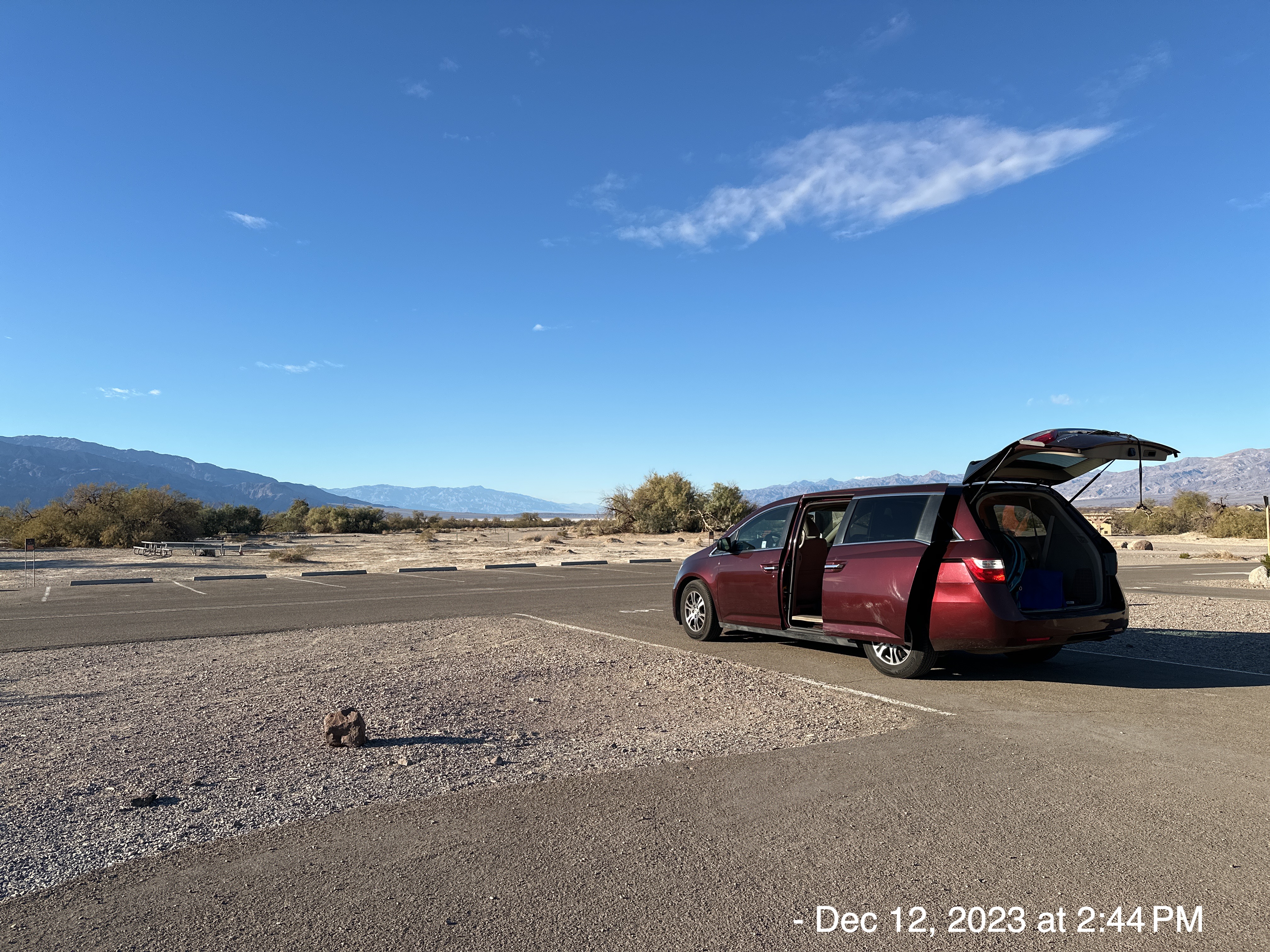
- 1st time camping in Death Valley.
- 2nd time camping near a filming location – The desert rock formations were used in the Star Wars movie series, including Episode IV – A New Hope and Episode VI – Return of the Jedi. (SHOW 1ST)
RECENT HISTORY
My previous outing was:
THIS TRIP
I wanted to camp in Death Valley, in order to get the full experience (the valley-part, not the death-part). I told that to a Park Ranger when I checked-in. He laughed and said, “Yeah, we like to say…. ‘Death Valley, all the features of Hell, without the eternity'”.

I sent this picture to my friend Mark. He said, “It looks a little flat and desert like “. He’s so funny!
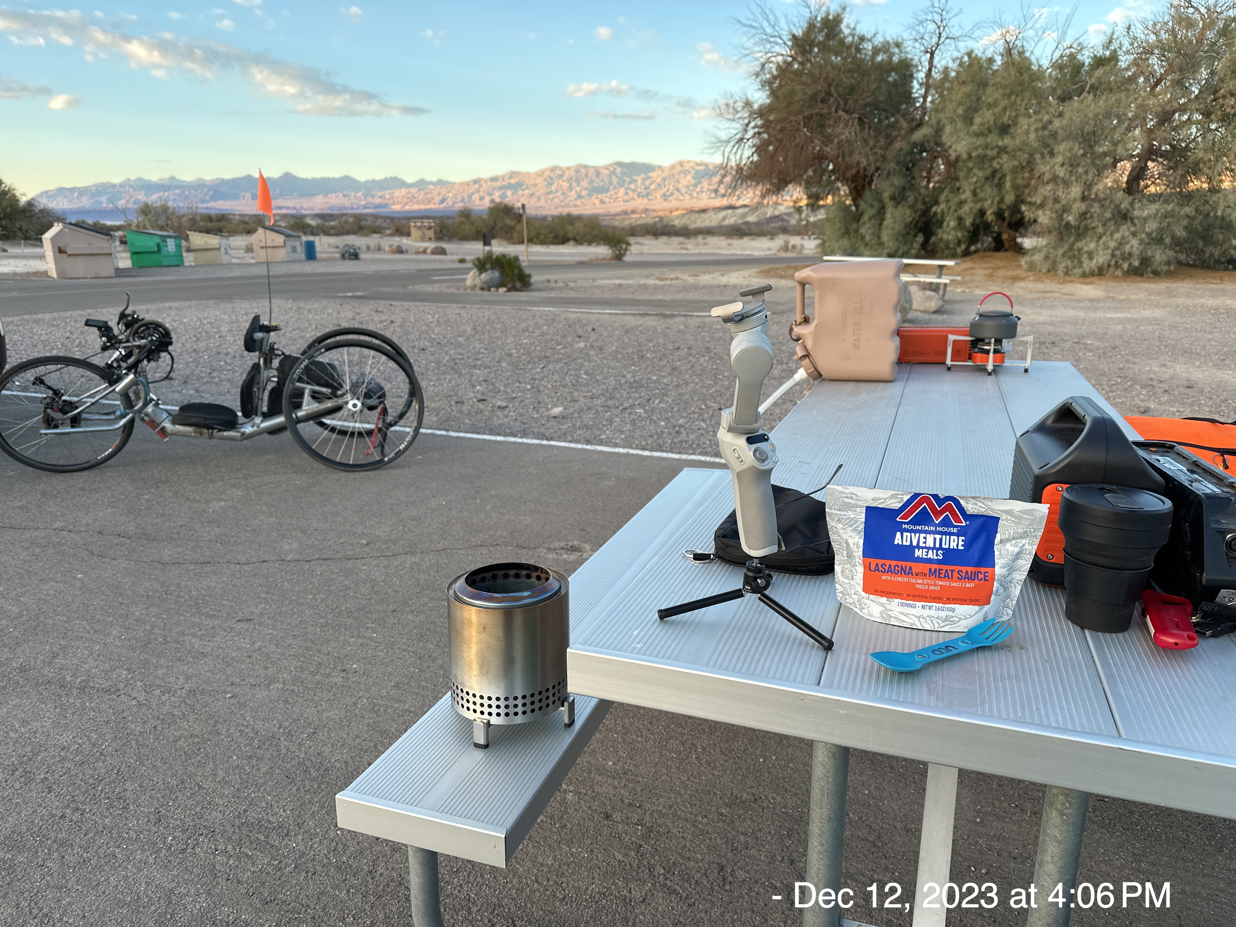
I got setup with two additions: 1) my solo-stove endorsed by Snoop-Dogg, portable campfire… more on that later and 2) a tripod for my camera to take nighttime pictures…more on that later as well. By the way, the lasagna was great. All the Italian freeze-dried meals are consistently fantastic.
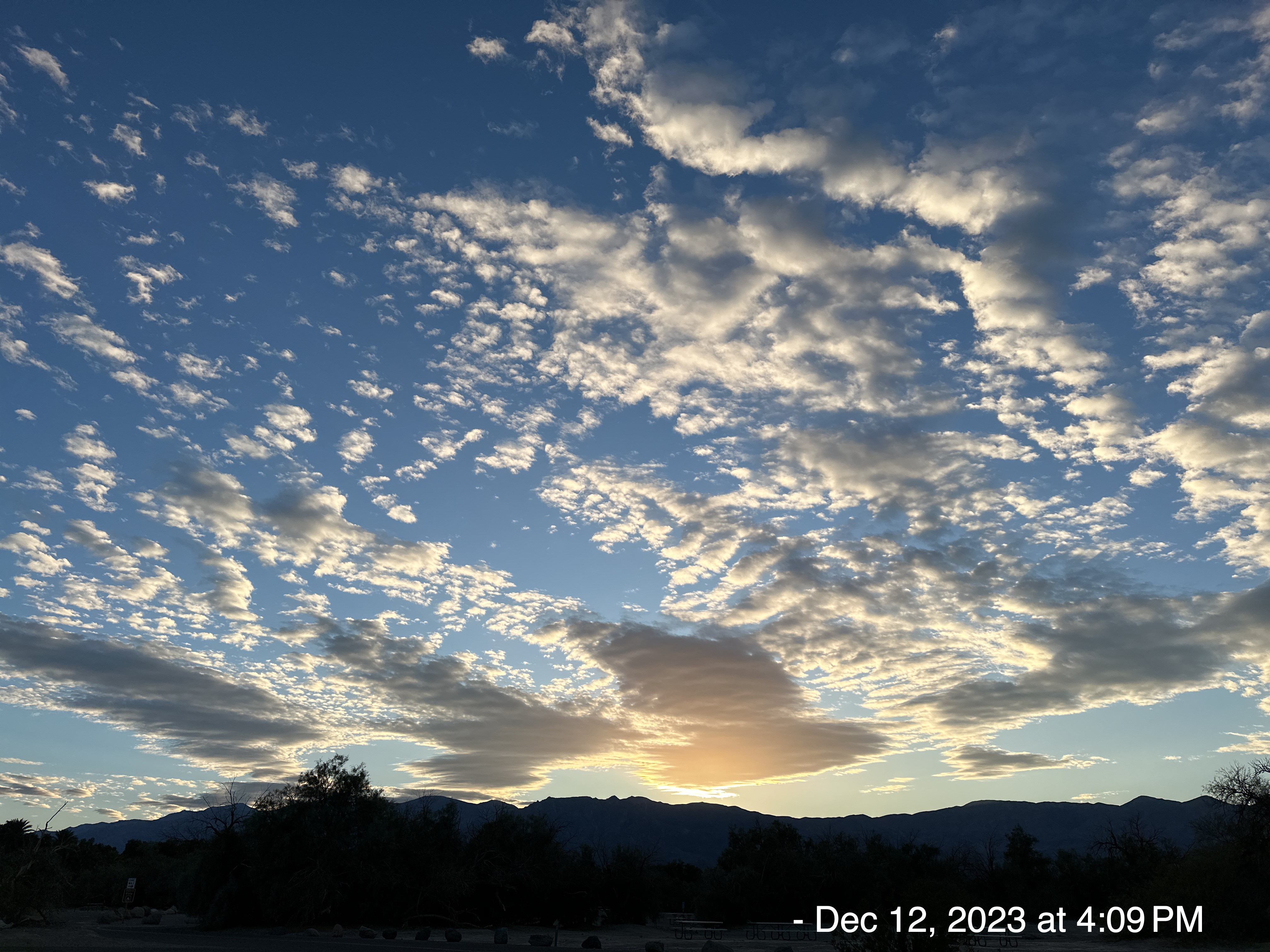
This was my view, just before sunset. It was surprisingly warm and no wind. That all changed quickly enough.
Here’s a video of my first wilderness campfire, that I handled all by myself (without lighting my clothes or flesh on fire, although I did smell some burnt hair… LOL!). I brought enough fuel for two nights. It was glorious, warm and peaceful.
Here are the pictures I took after going to bed…. and waking up to pee.
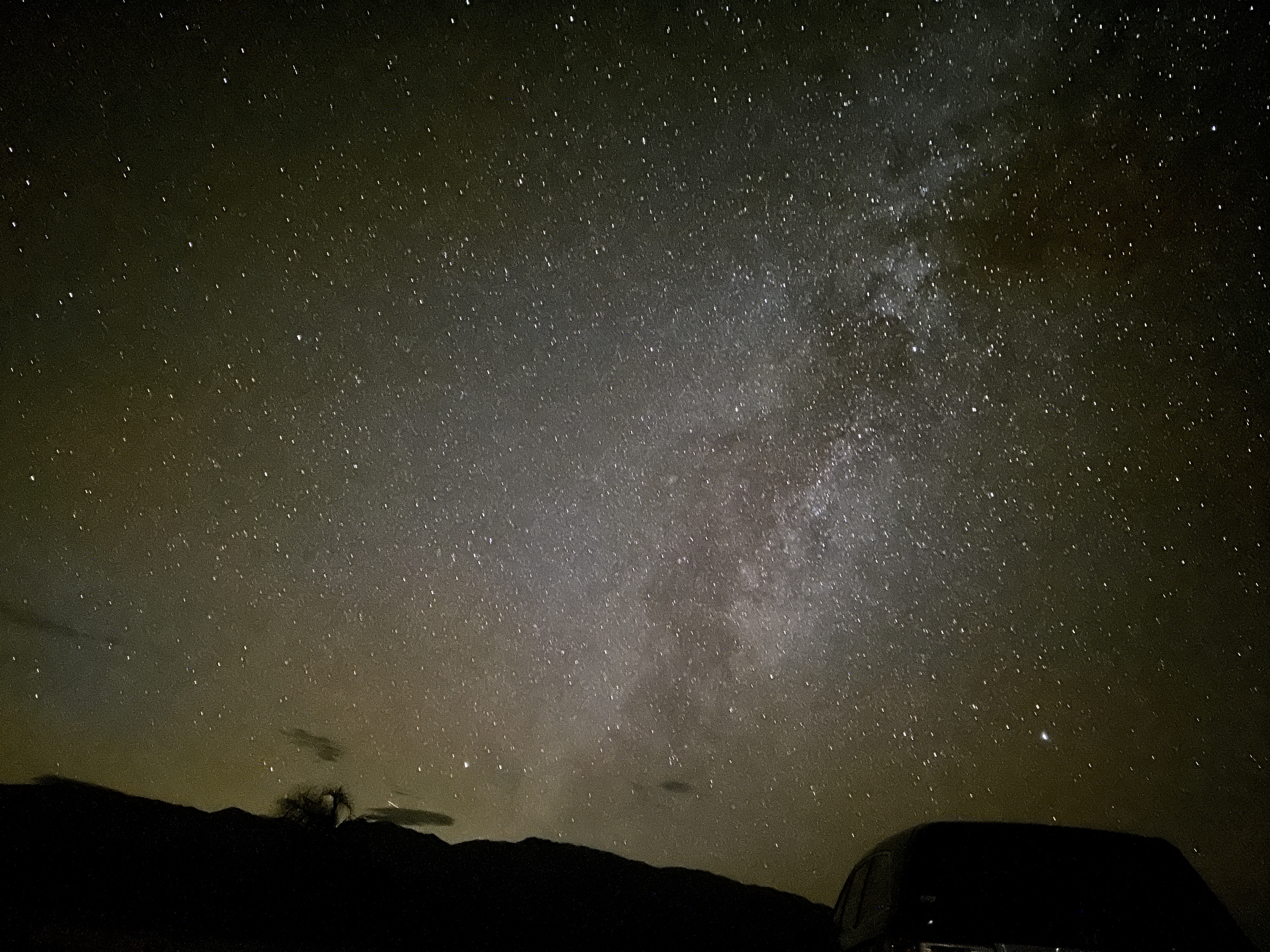
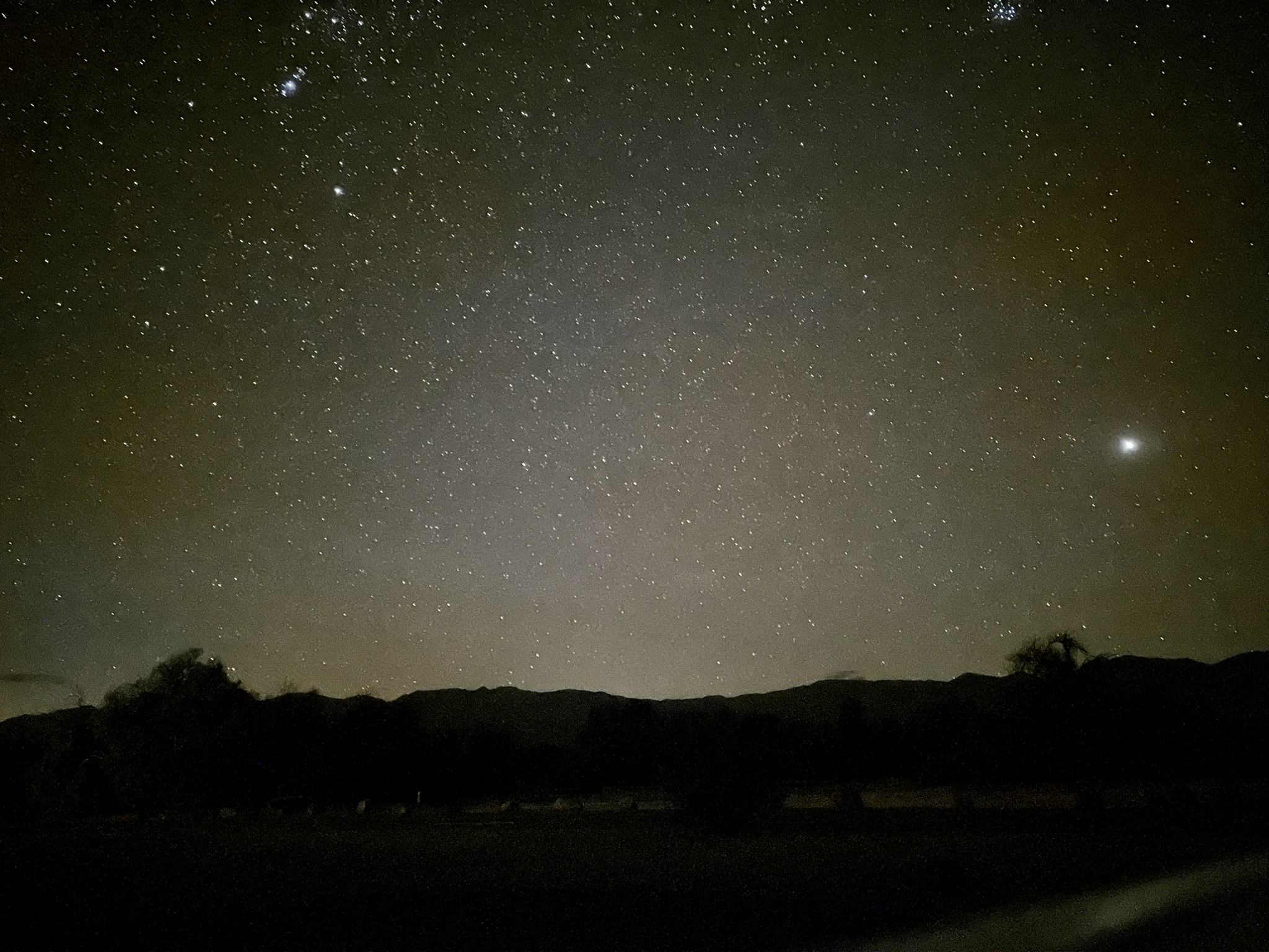
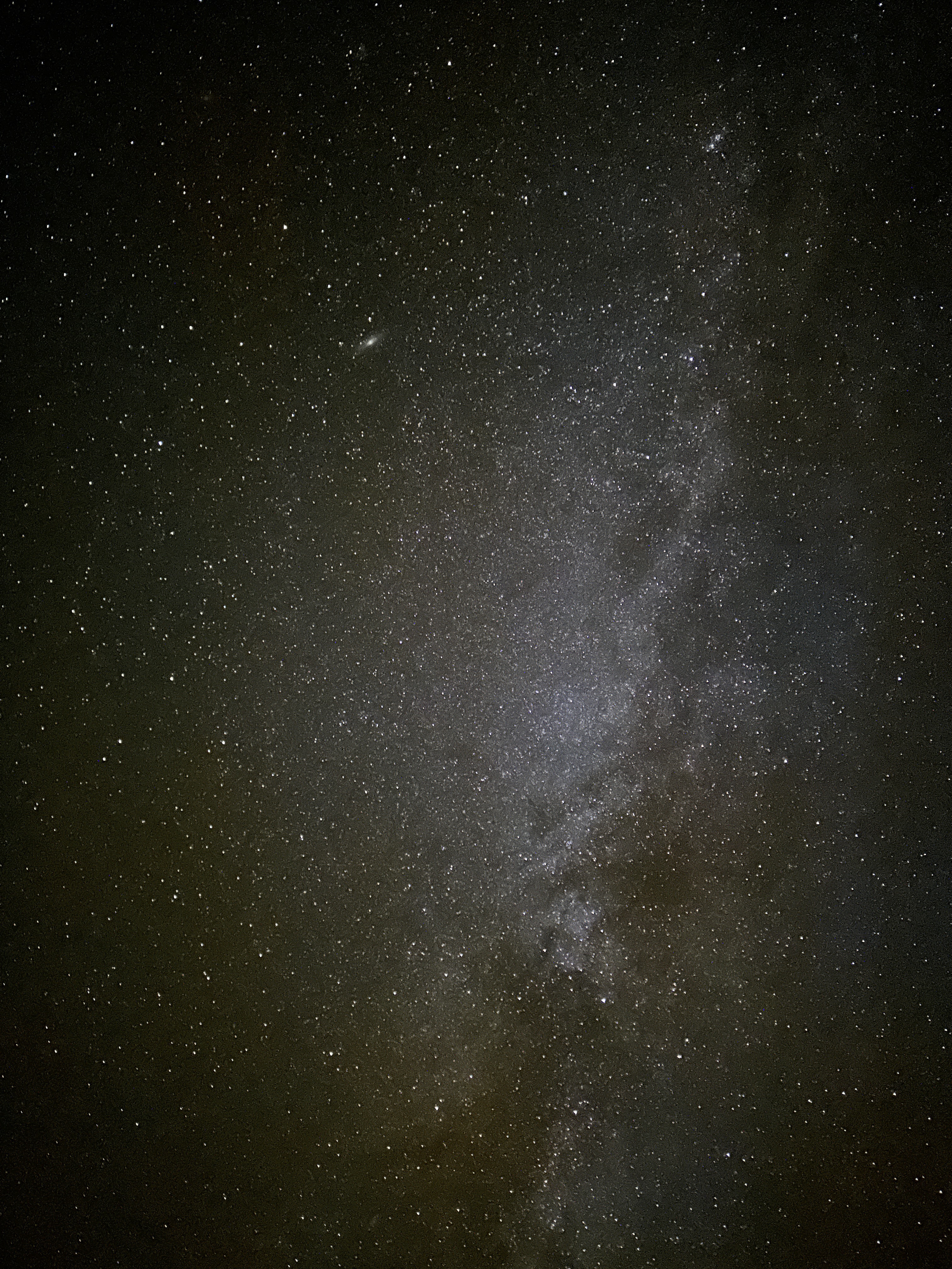
On December 12th, I believe I captured a meteor. If you look in the lower left quadrant of the following picture, I think you will see the trail of a Geminid meteor. The 2023 Geminid meteor shower peaks in the evening of December 14th. The Geminids are caused by debris from an asteroid called 3200 Phaethon. Phaethon’s 524-day orbit carries it very close to the Sun, less than half the distance of Mercury’s closest approach to the Sun.
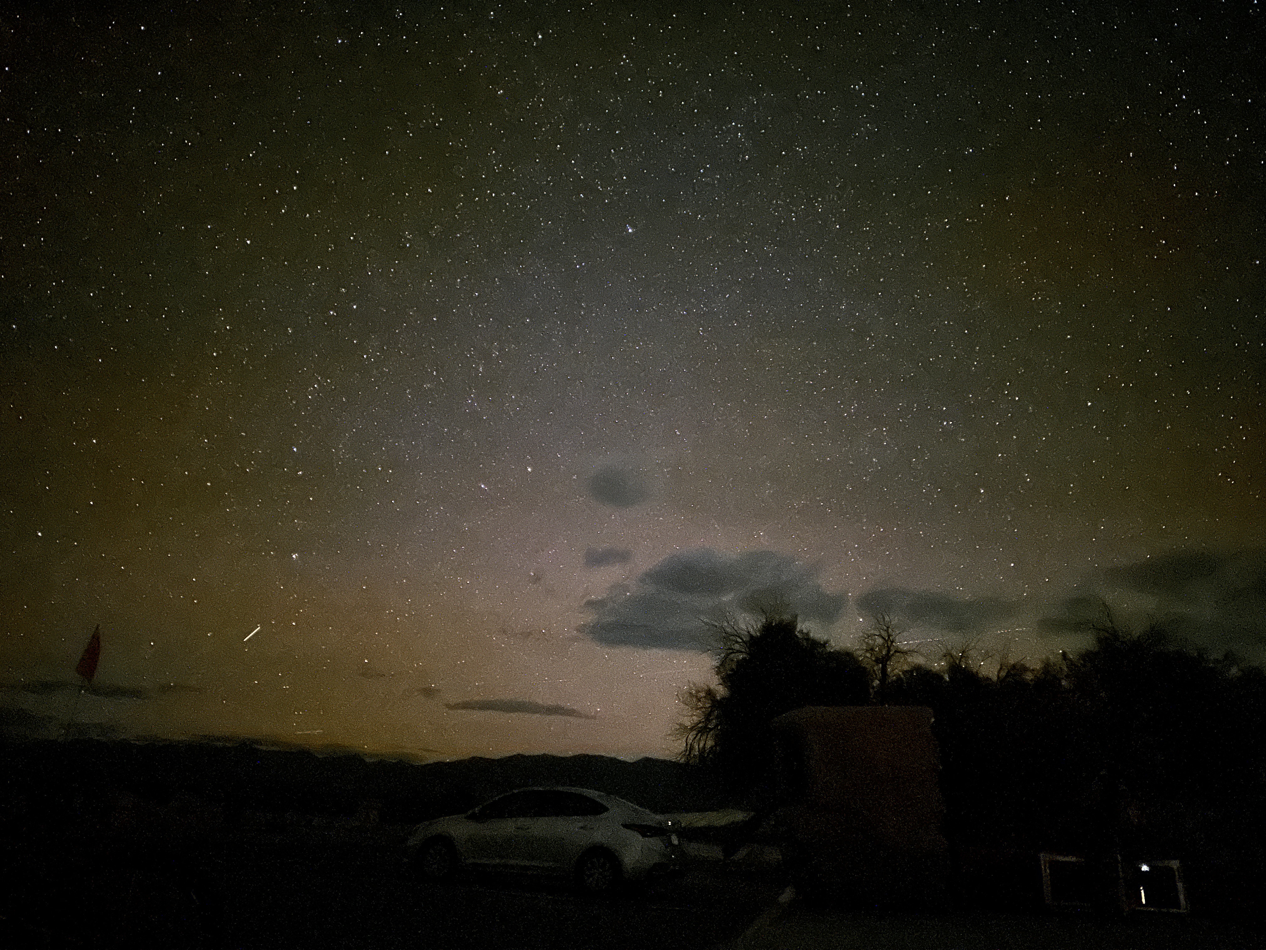
The following picture was taken eastward. I don’t know if the brightness over the horizon is Las Vegas or not. It probably is.
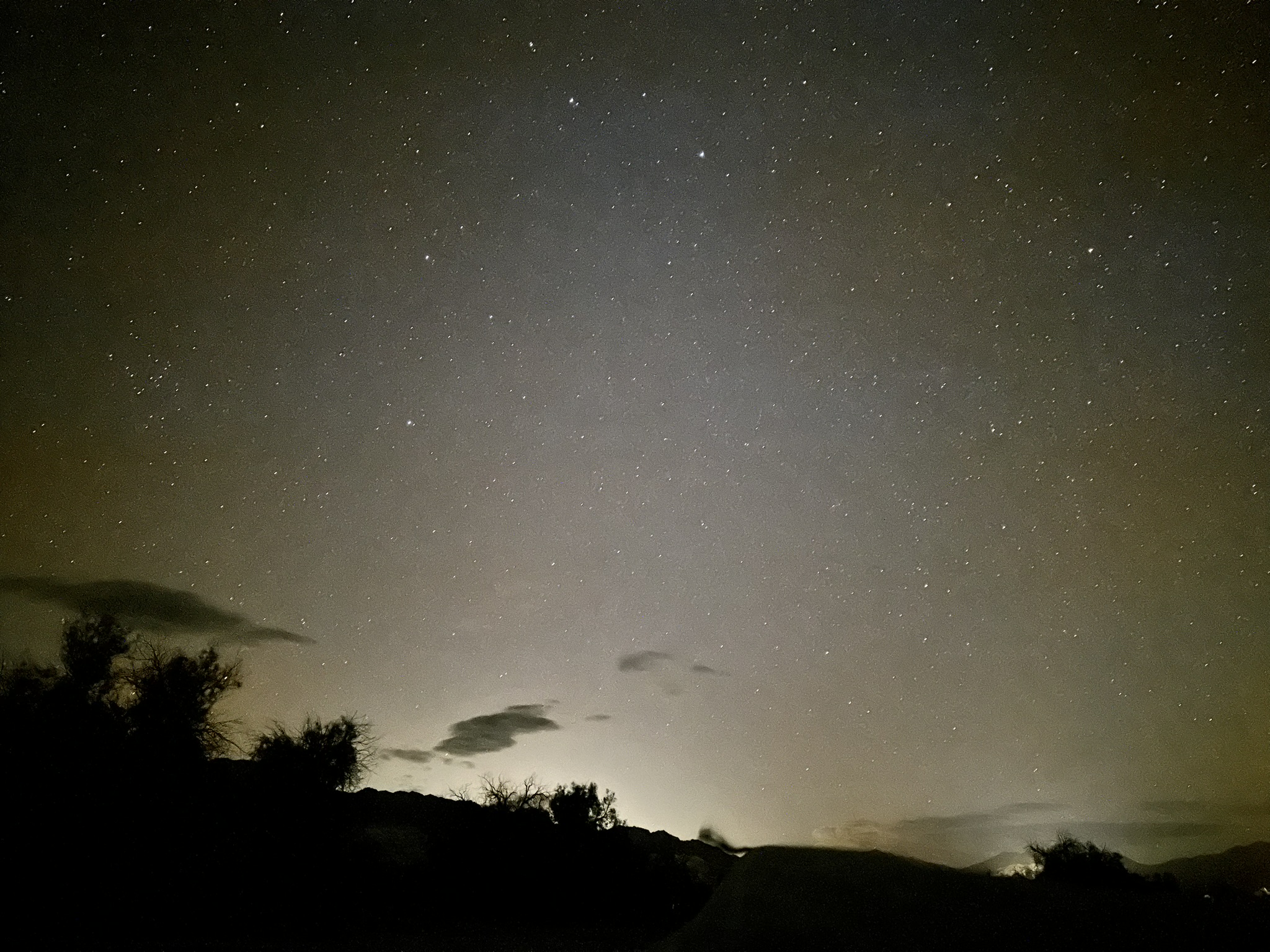
I’m amazed at how many stars were visible.
There were only a couple of small clouds.
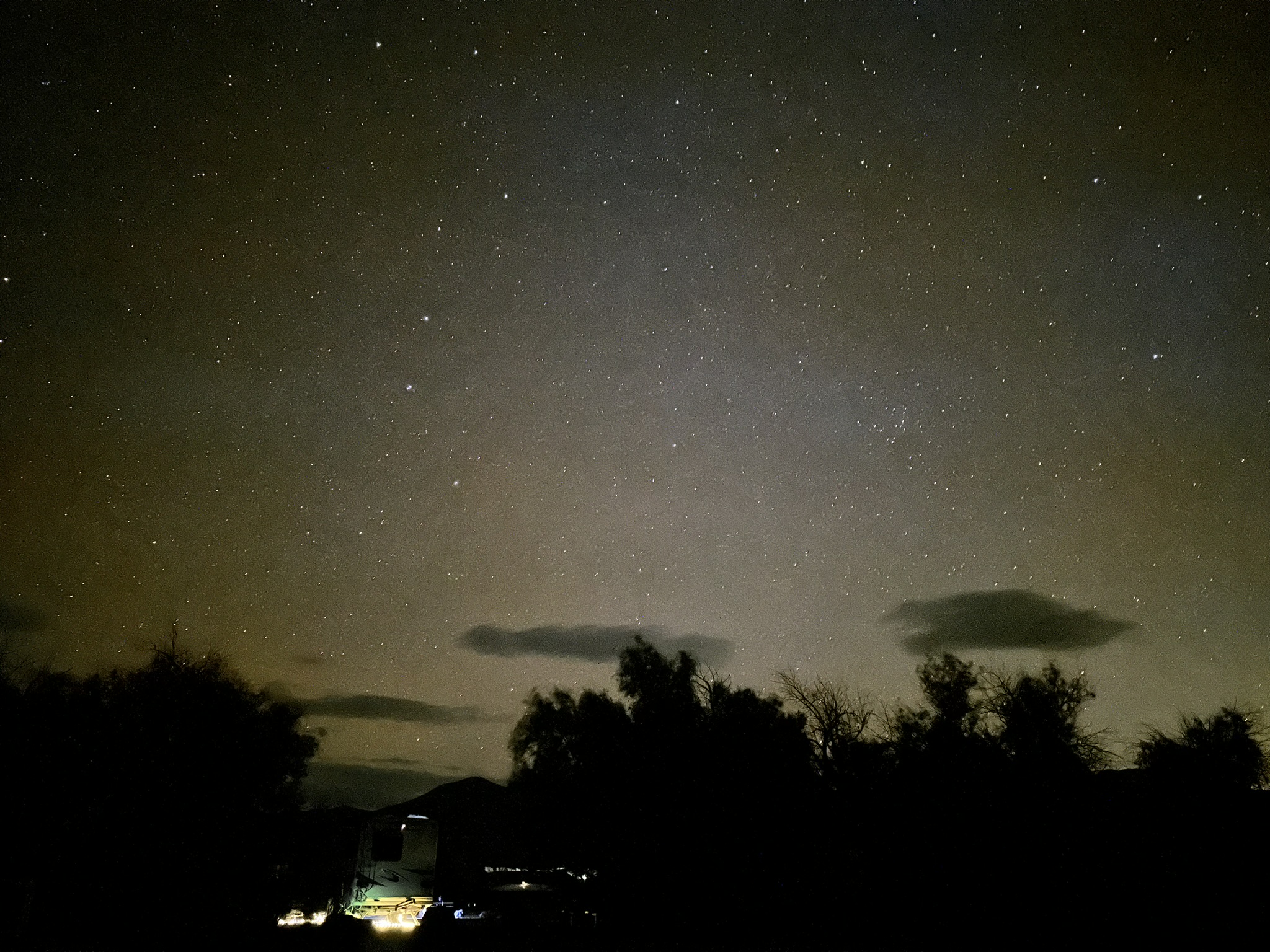
This was the most AMAZING night sky picture I took. I upgraded my phone this year to get better pictures, and it was all worth it for this.
CLICK HERE FOR THE CONSTELLATIONS I HAVE SEEN
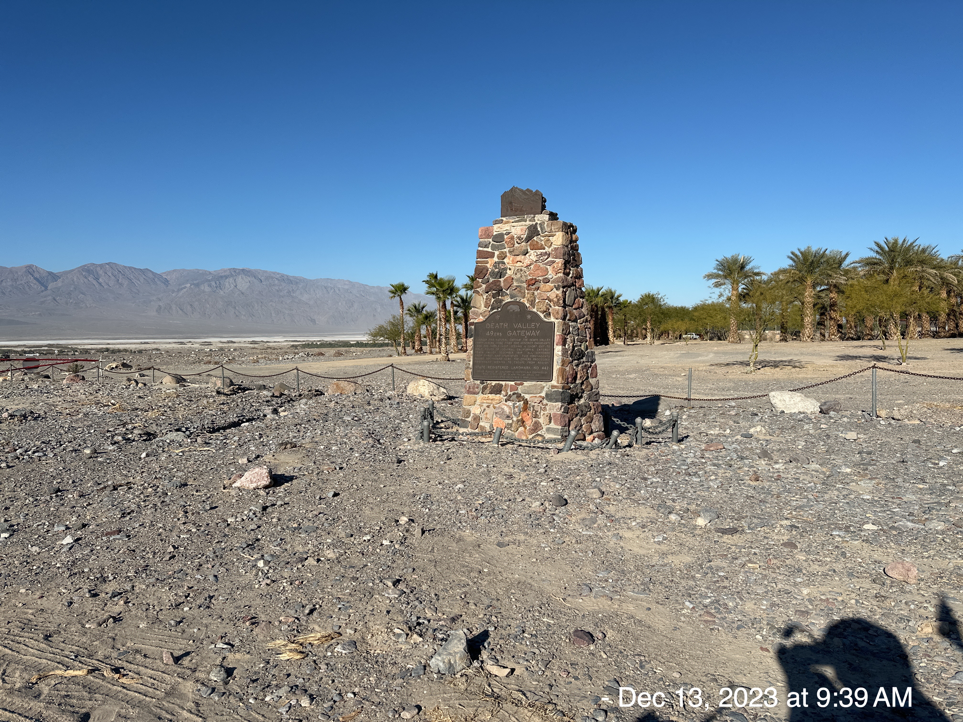
I stopped on my bike ride to see this historical marker “Death Valley 49ers Gateway – Through this natural gateway the Death Valley Forty-Niners, more than one hundred emigrants from the middle west, seeking a shortcut to gold fields of central California, entered Death Valley in December, 1849. All suffered from thirst and starvation. Two contingents went southwest from here, the others proceeded northward seeking an escape from the region.”
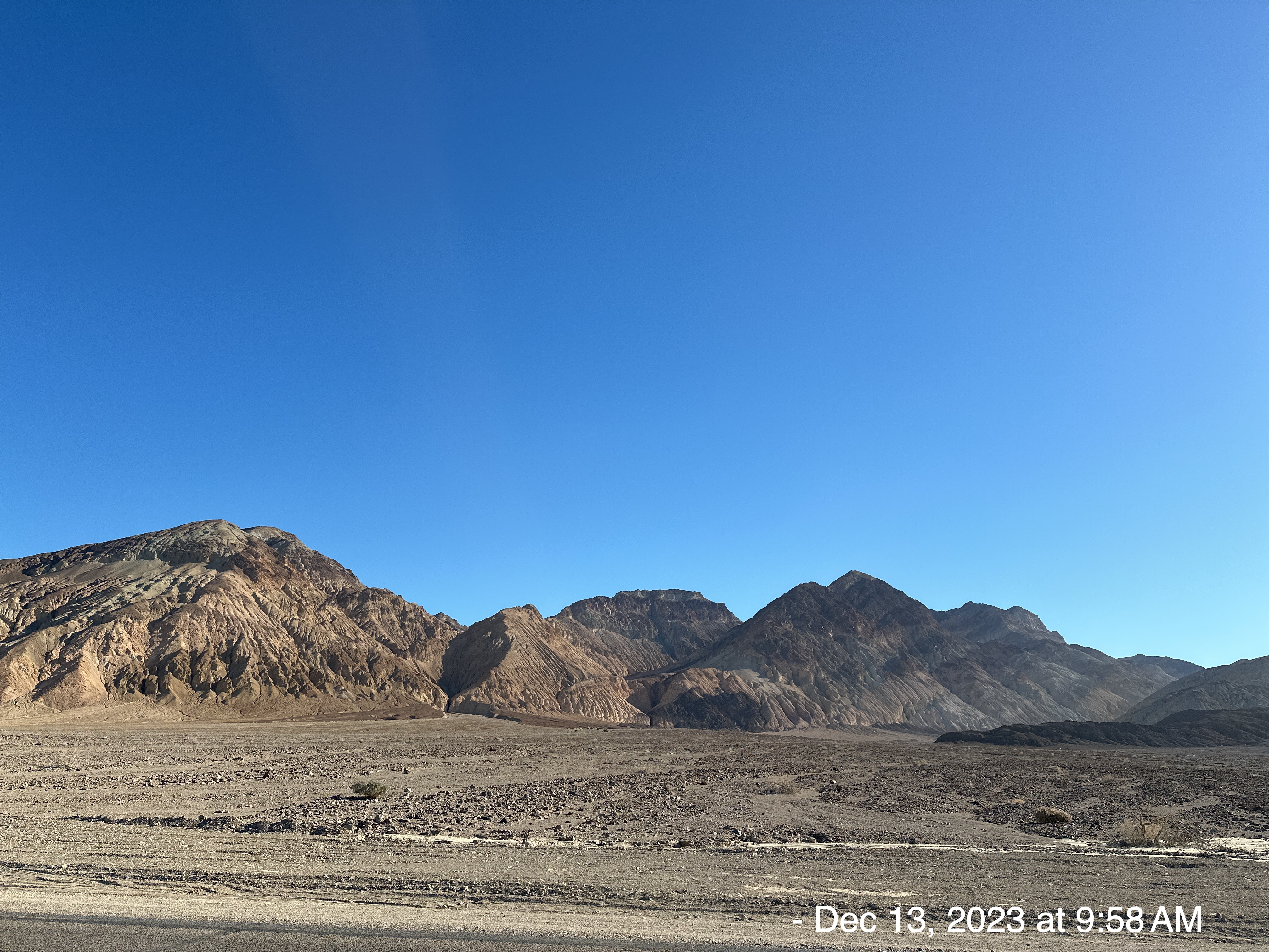
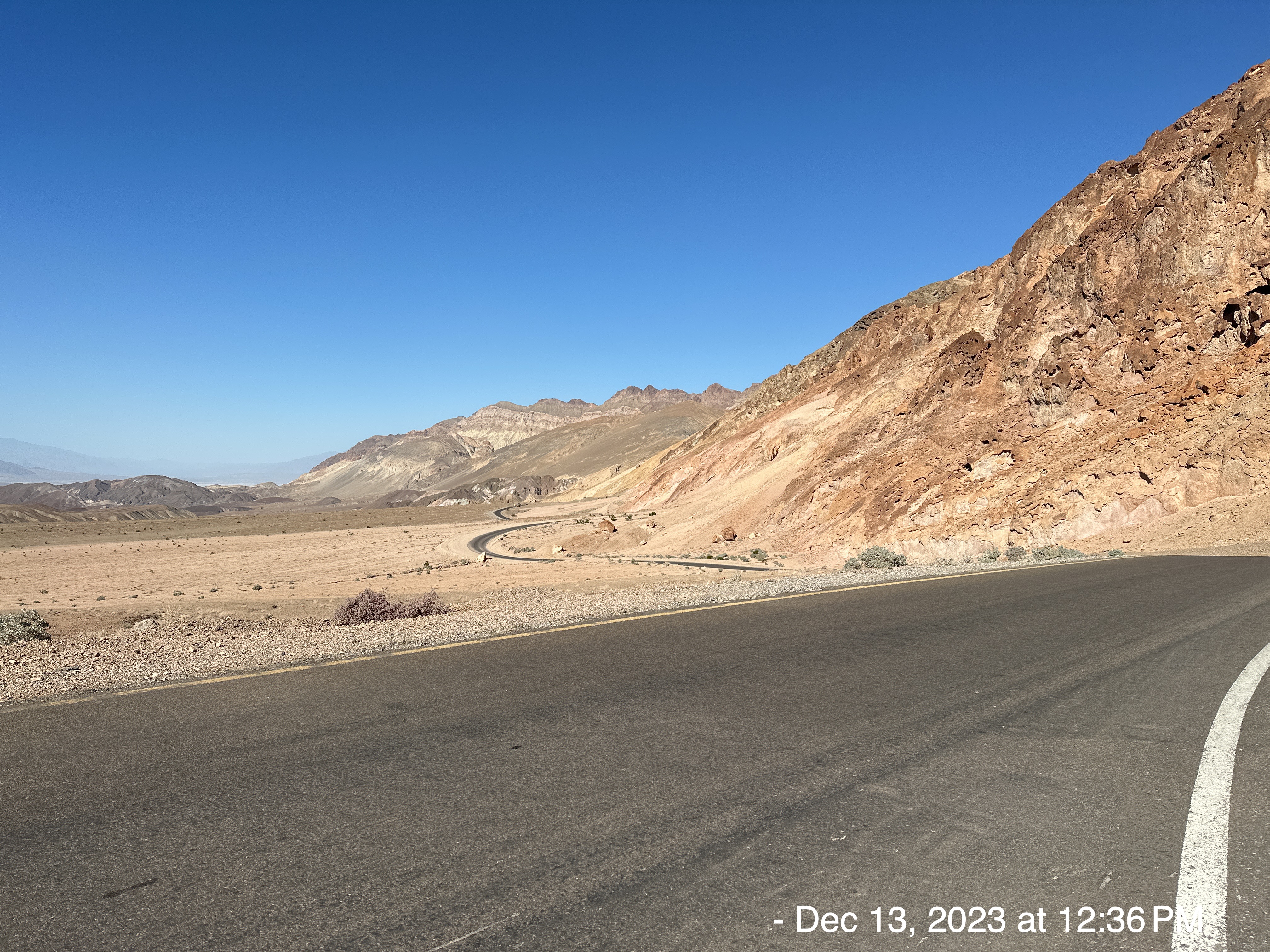
From there, I turned right along the Badwater Road which heads south from CA-190, eventually turning east on its way out of Death Valley National Park.
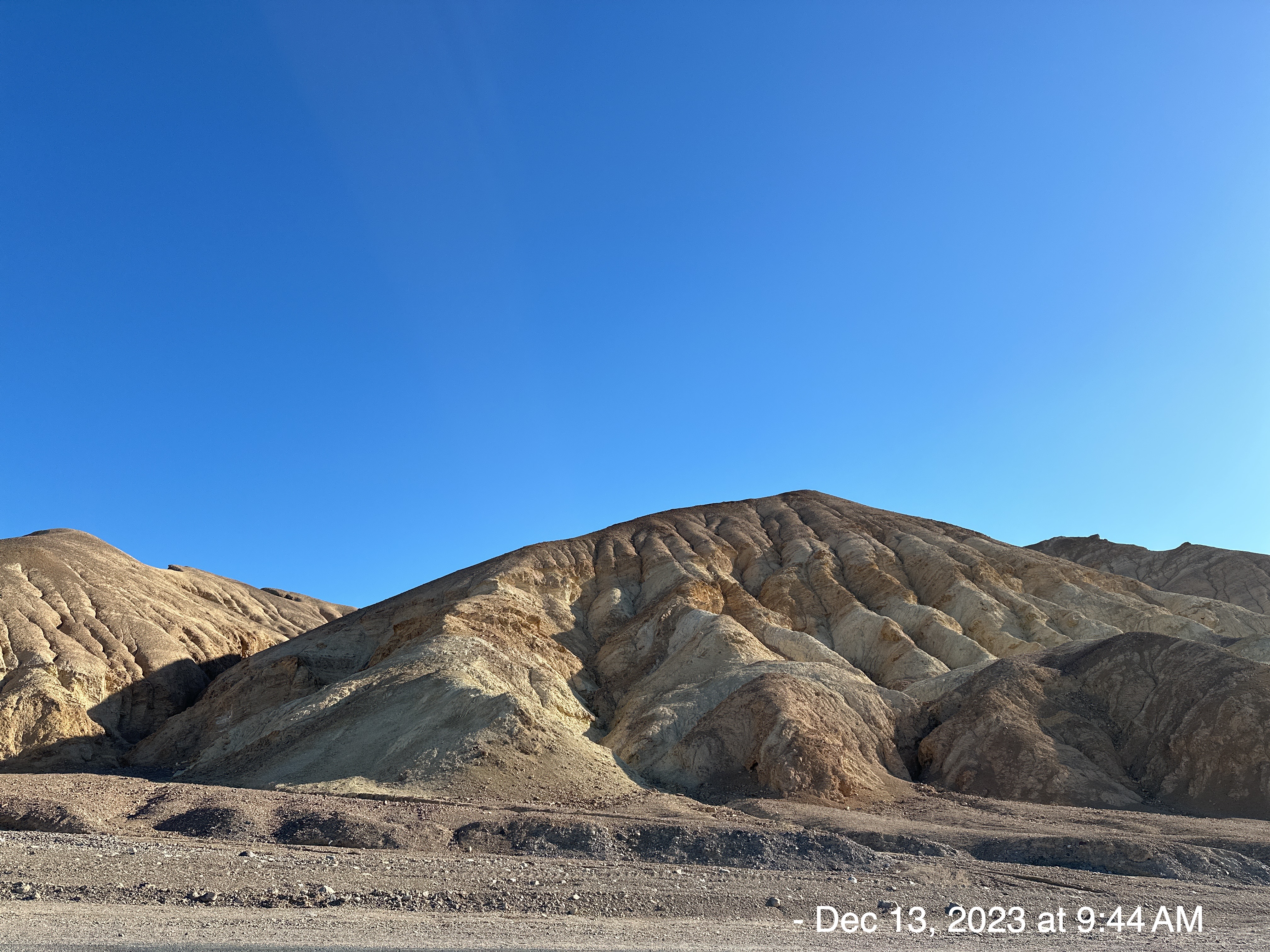
The mountains to my left were beautiful.
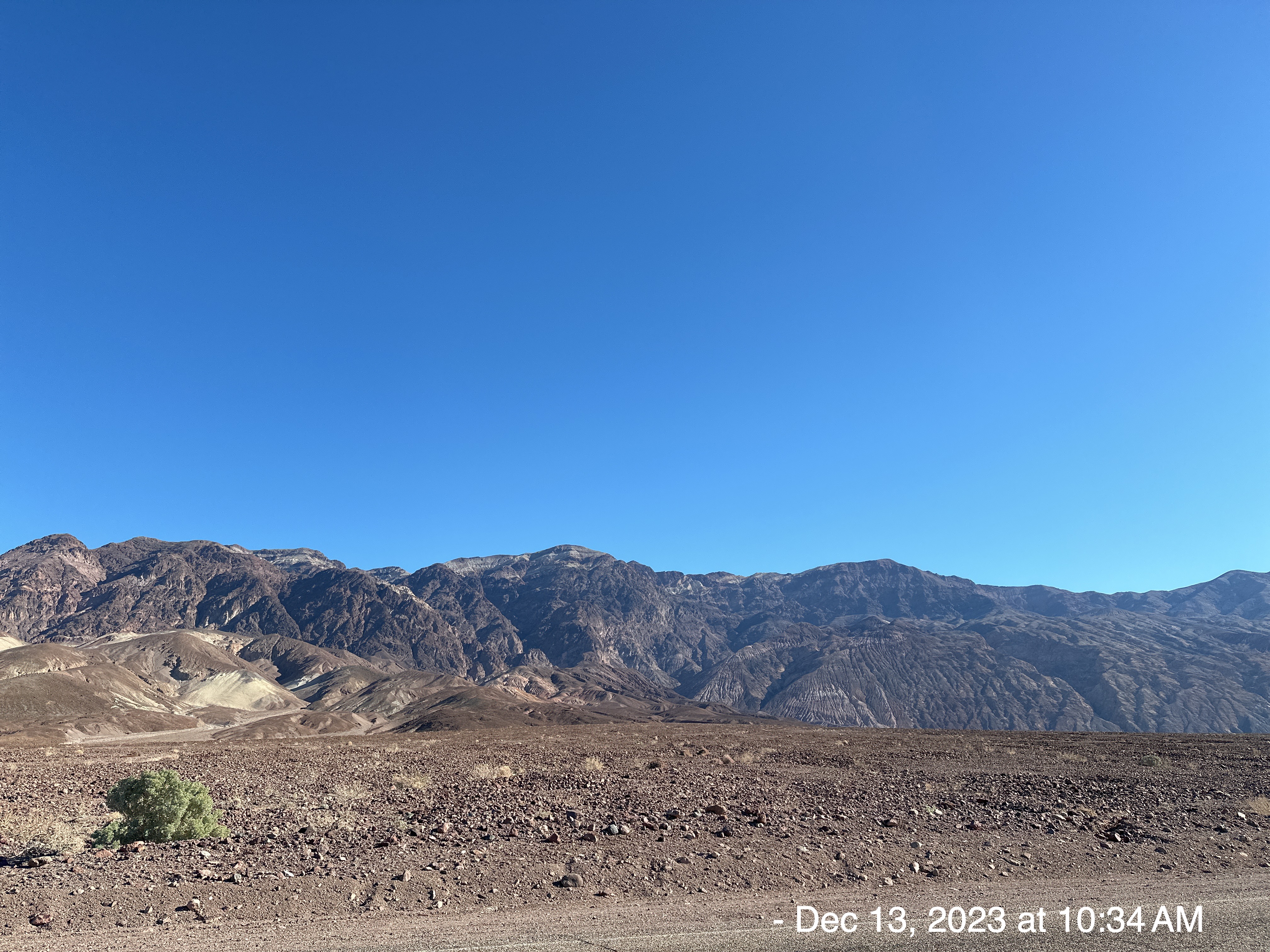
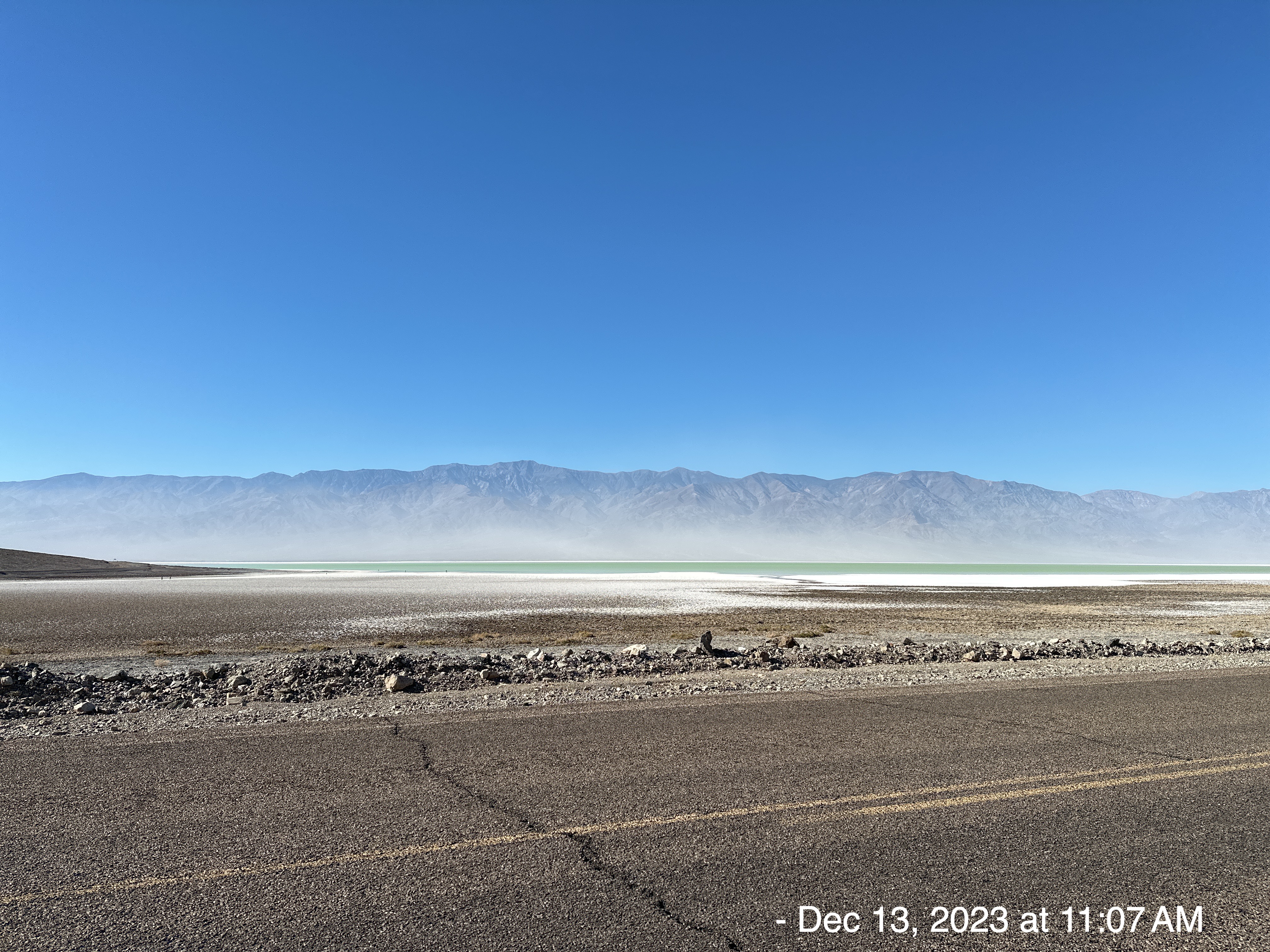
My ultimate goal was Badwater Basin, the lowest land in the Northern Hemisphere.
The following 3 pictures were taken illegally. There was a sign that said, “No Bikes”. Have you ever known me to obey the rules? Ask the Marines at Camp Pendleton. I disregarded these instructions and rode out to the edge of the water.

At Badwater Basin, significant rainstorms flood the valley bottom periodically. The area was named Badwater because a traveler was coming through and saw that there was water for his mule to drink. However, because the water is so full of salt, the animal refused to drink it, and thus the name Badwater was born.
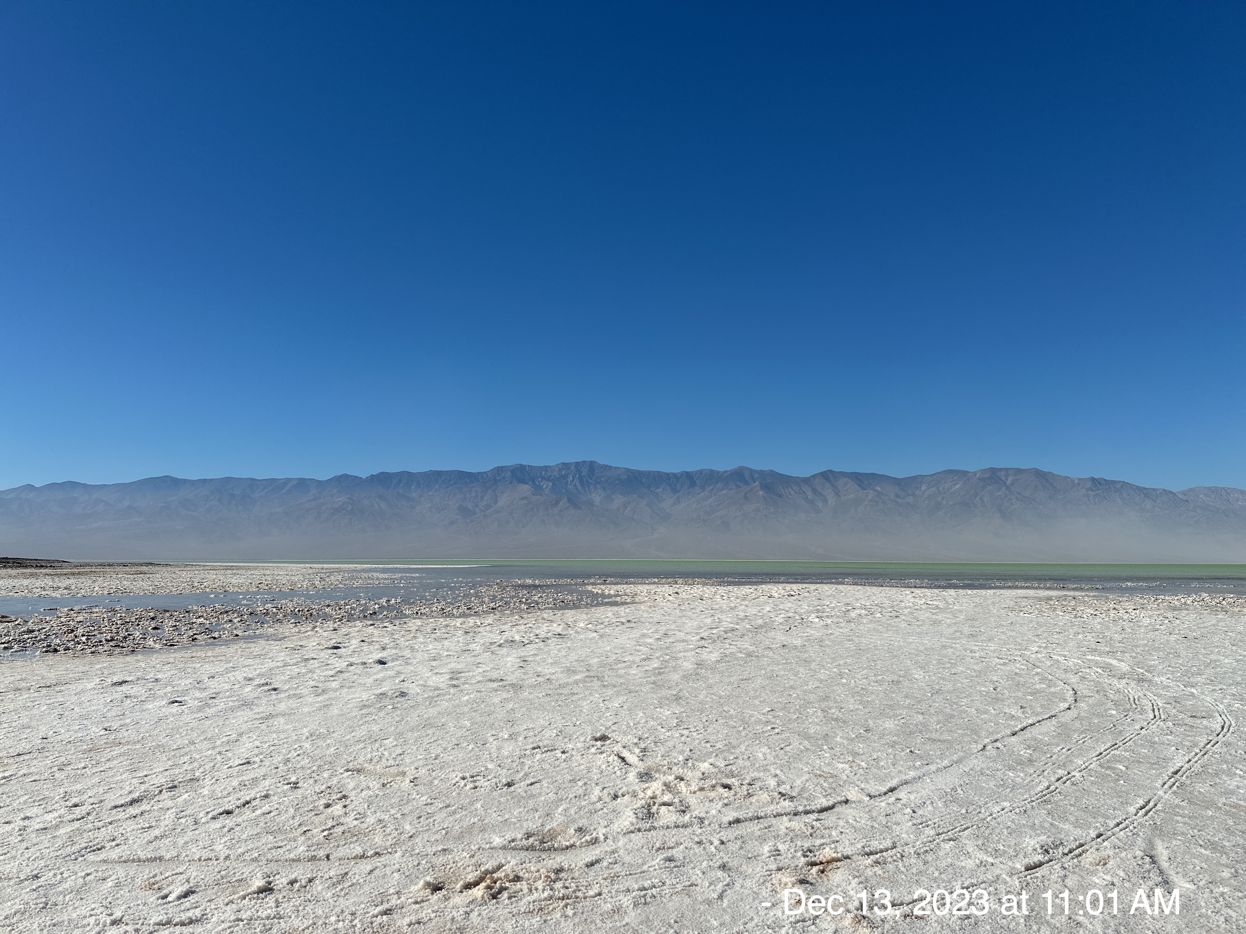
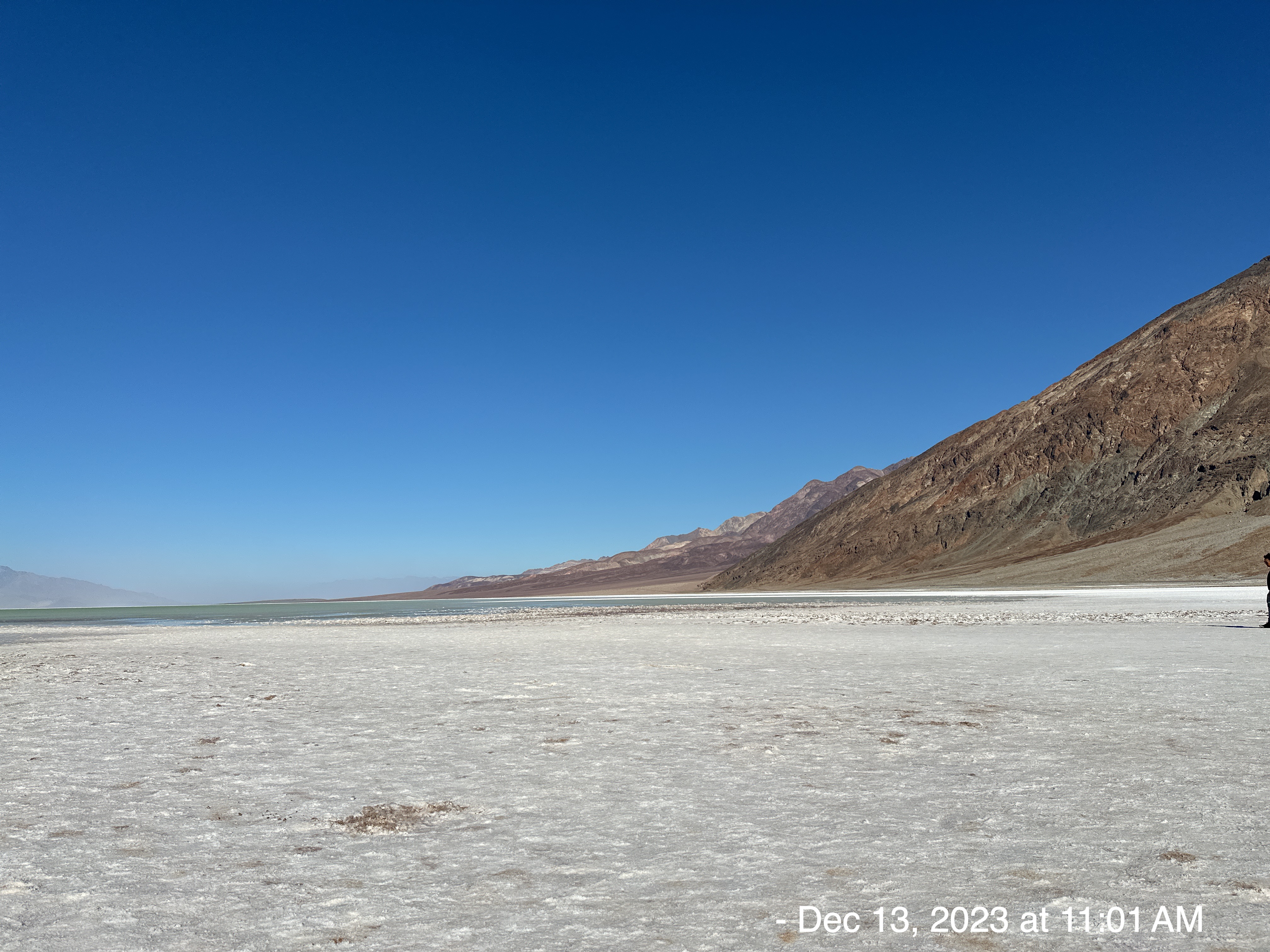
On August 20, 2023, remnants from hurricane Hilary dropped about a year’s worth of rain for the park in just one day. The rainwater flowed into nearly every basin in the park, forming temporary lakes. The Badwater basin filled with about 2 feet of water soon after the storm. The last time a similar lake formed at Death Valley was in 2005.
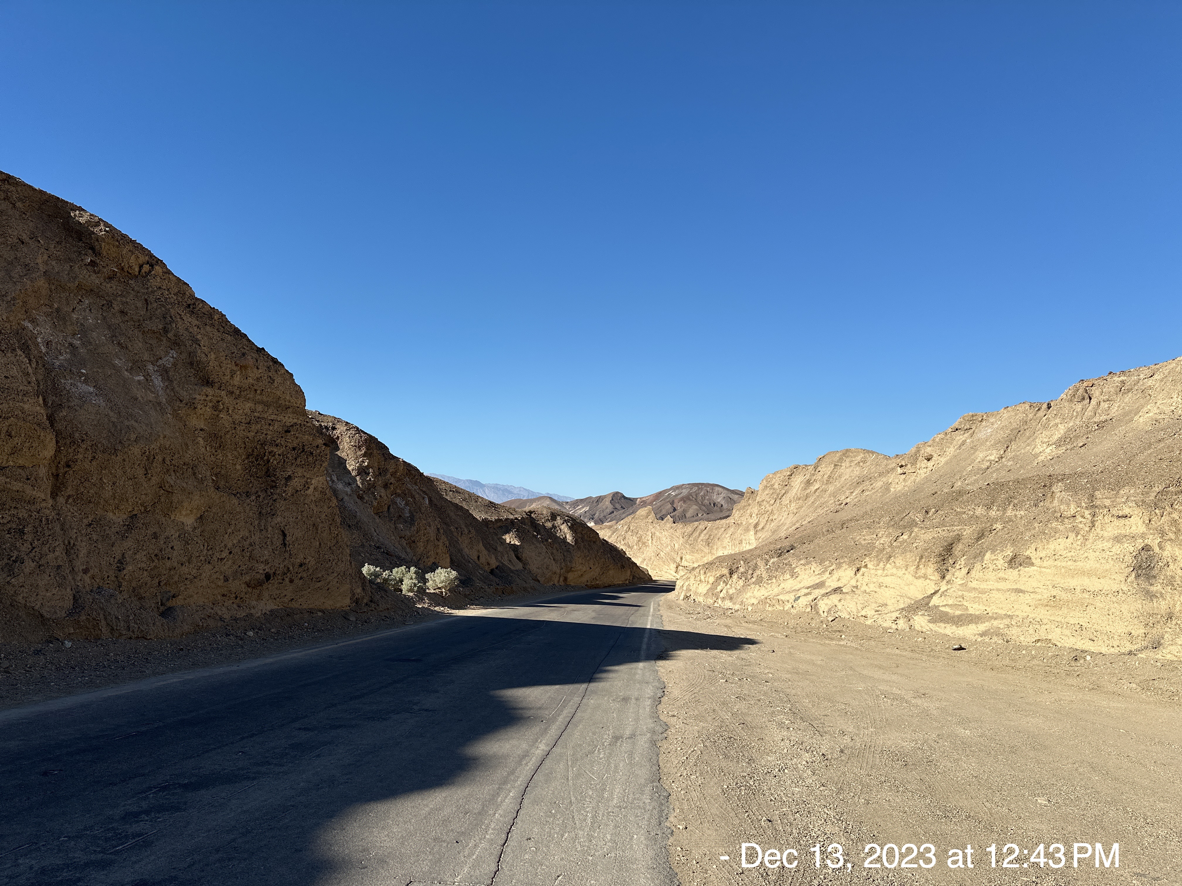
On my way back from Badwater, I took the following picture. Not long afterwards, the wind blew my knit-cap, “beanie” off into the great unknown. It’s my fault, I should have secured it more carefully behind my bike seat……….. Or, maybe it was the Devil just trying to mess with me!
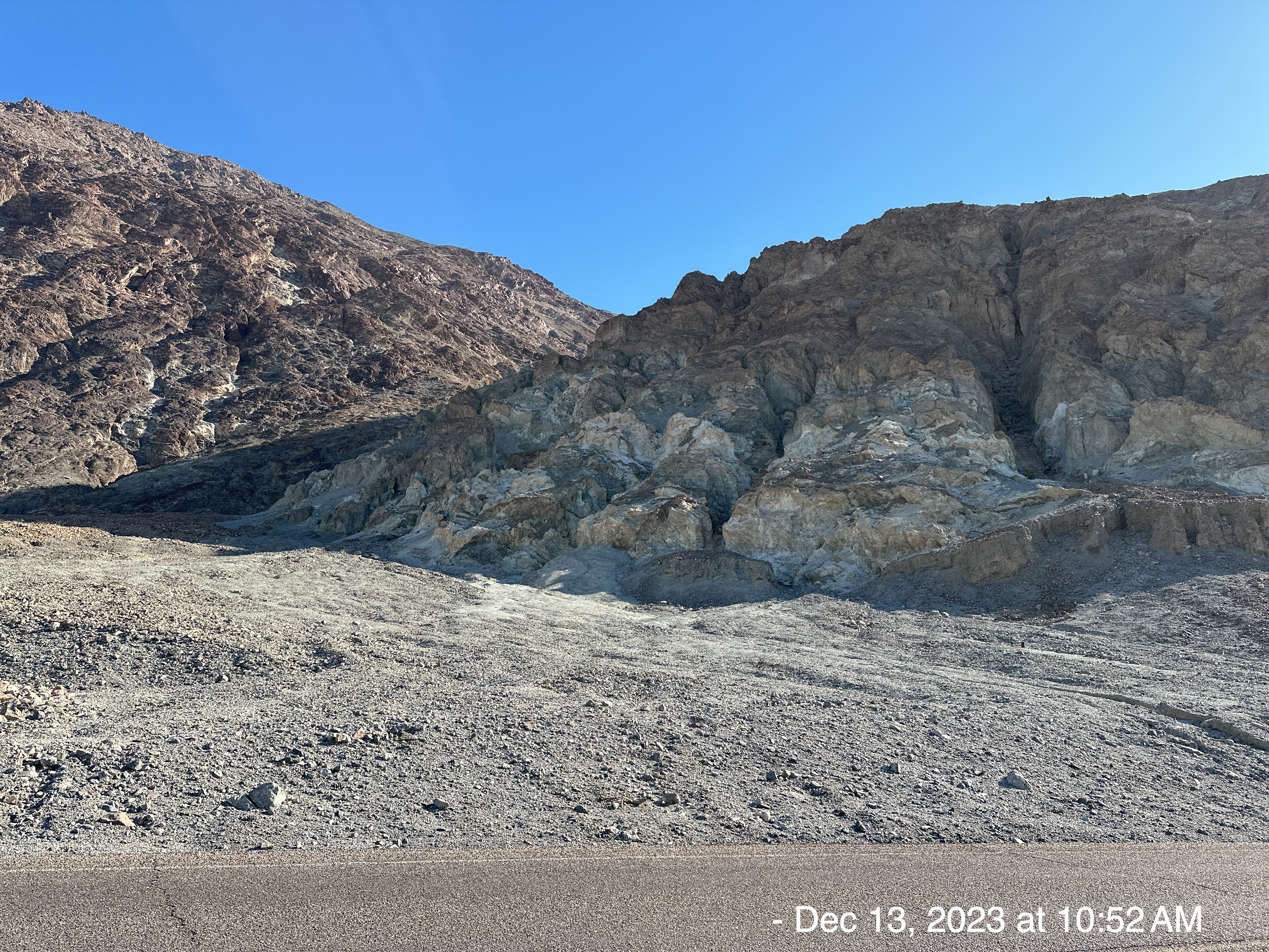
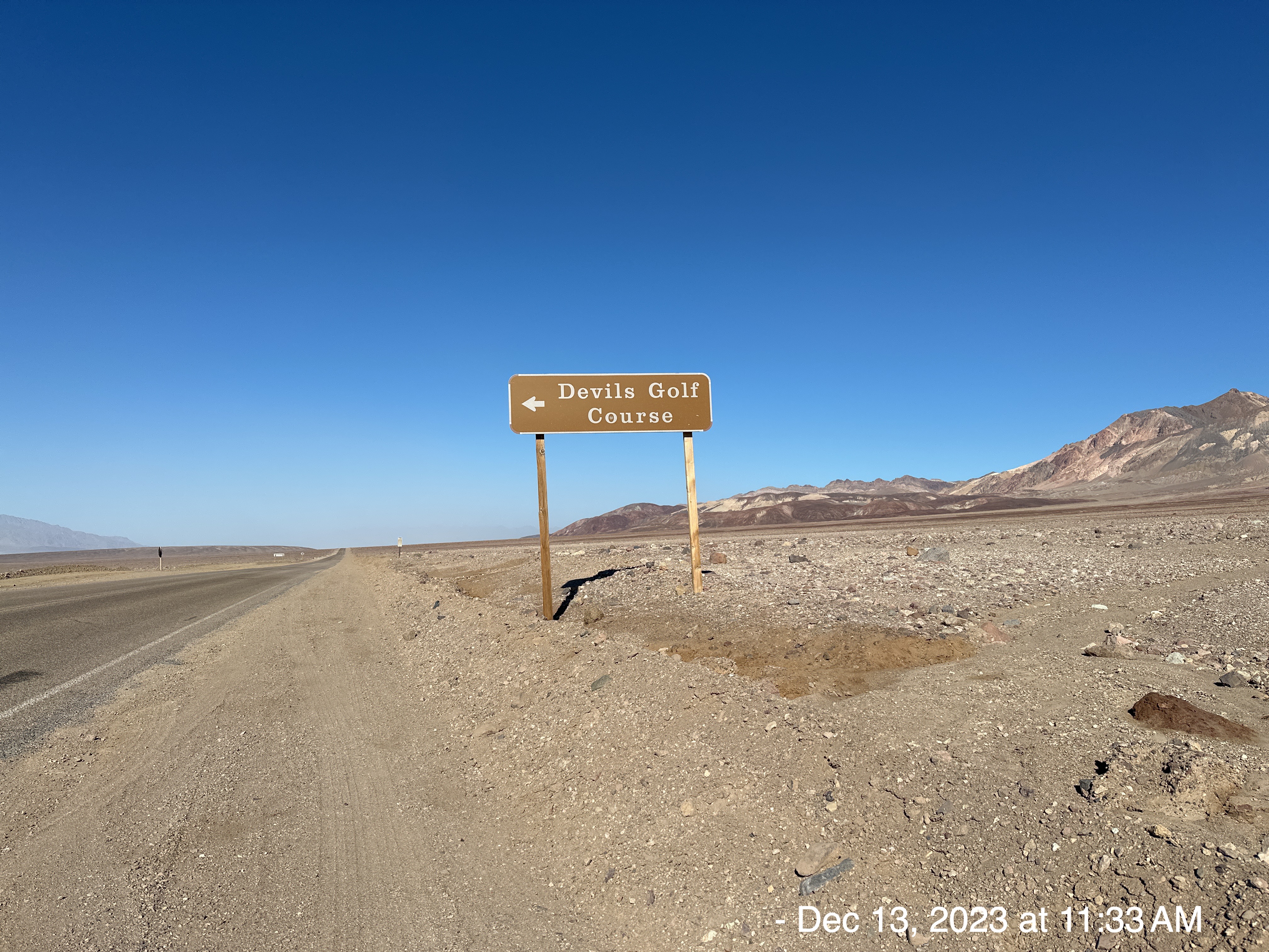
This natural formation is a bizarre area of rocks and salt crystals. Why does the Devil get so many landmarks? I don’t understand.
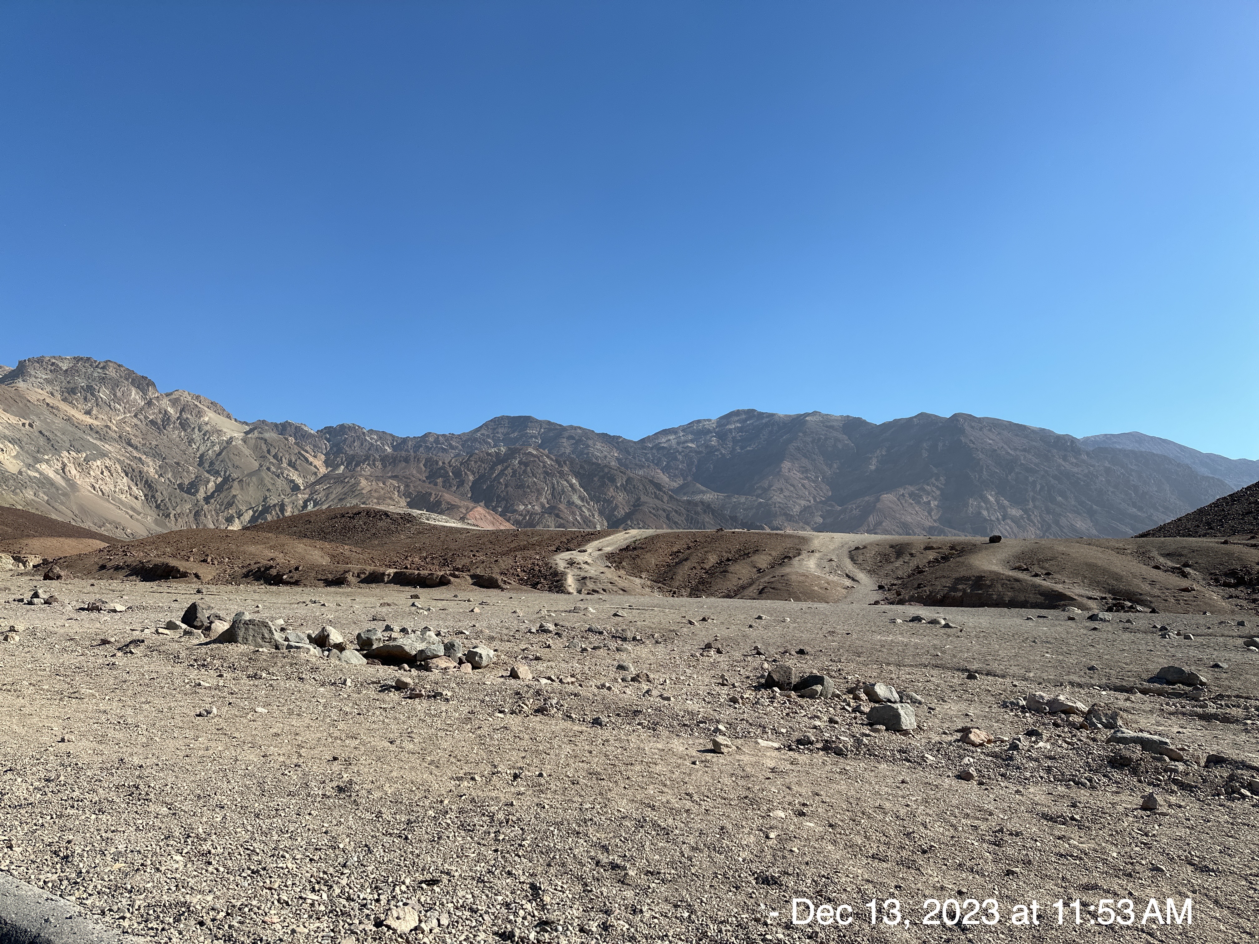
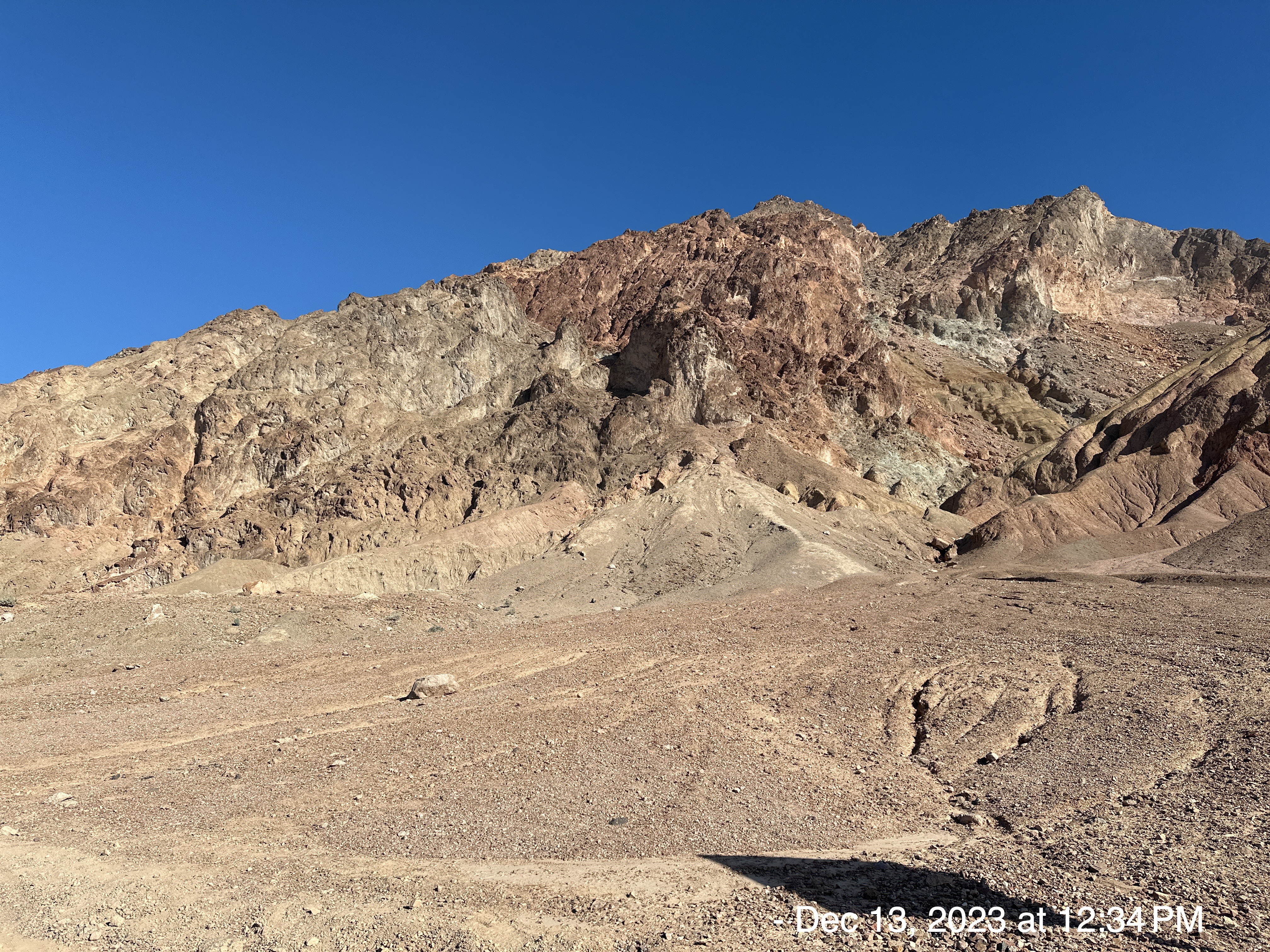
I decided to take a 9-mile detour through “Artist Drive” with an average gradient of 7.1%. One of the Park Rangers suggested it to me. The brochure says, “This is a must-do side trip. The road travels through highly colorful formations, including the spectacular Artists Palette.” Along with Dante’s View, this is my favorite bike climb.
The vibrant colors here are due to a unique set of oxidized minerals (iron, aluminum, magnesium and titanium) in a concentrated area.
The steepest quarter mile of this climb is 11.3% and steepest continuous mile is 9.9%.
I could have made it back to my campsite without changing batteries. But, because I chose to take the detour along Artist Drive, I had to swap batteries. A dozen cars drove past me while I was pulled over on the side of the single-lane road. Only about 1/3 of the people stopped and asked me if I needed help. Two women were riding their bikes up the road, and they were very kind to ask me if there was anything I needed. They “get it”.
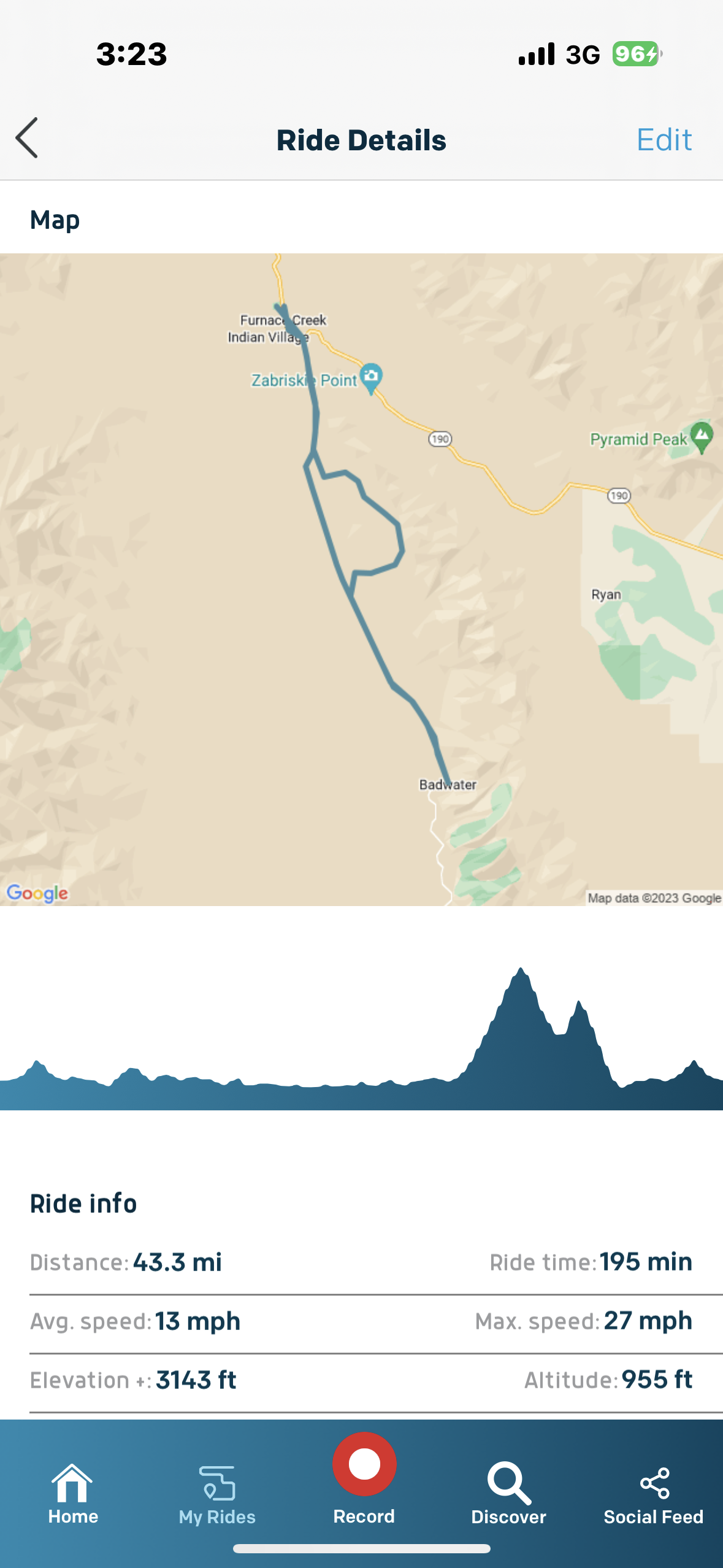
I was wiped out when I got back to my campsite. I had left around 9:30am and I didn’t get back until around 2:00pm. The National Weather Service recorded wind speeds of 10mph with gusts to 15mph. I was soooo dehydrated by the time I finished. I forget how much my eyes and skin suffer in those conditions. YES, I brought water, and I took a small sip. I held back in case I had to ration my provisions in life-threatening circumstances.
Then, that night was 5 degrees colder than the day before. I lost my beanie, and I was feeling quite a bit colder. QUESTION: Do we really lose most of our heat through our heads? ANSWER: Lots of people believe that, but this pearl of motherly wisdom is FALSE (source: WebMD). Doesn’t matter…. I felt much colder, and I blame the Devil for stealing my beanie!
On my up Highway 127, I came across this sign. The name of the trail looked familiar, so I took a picture.
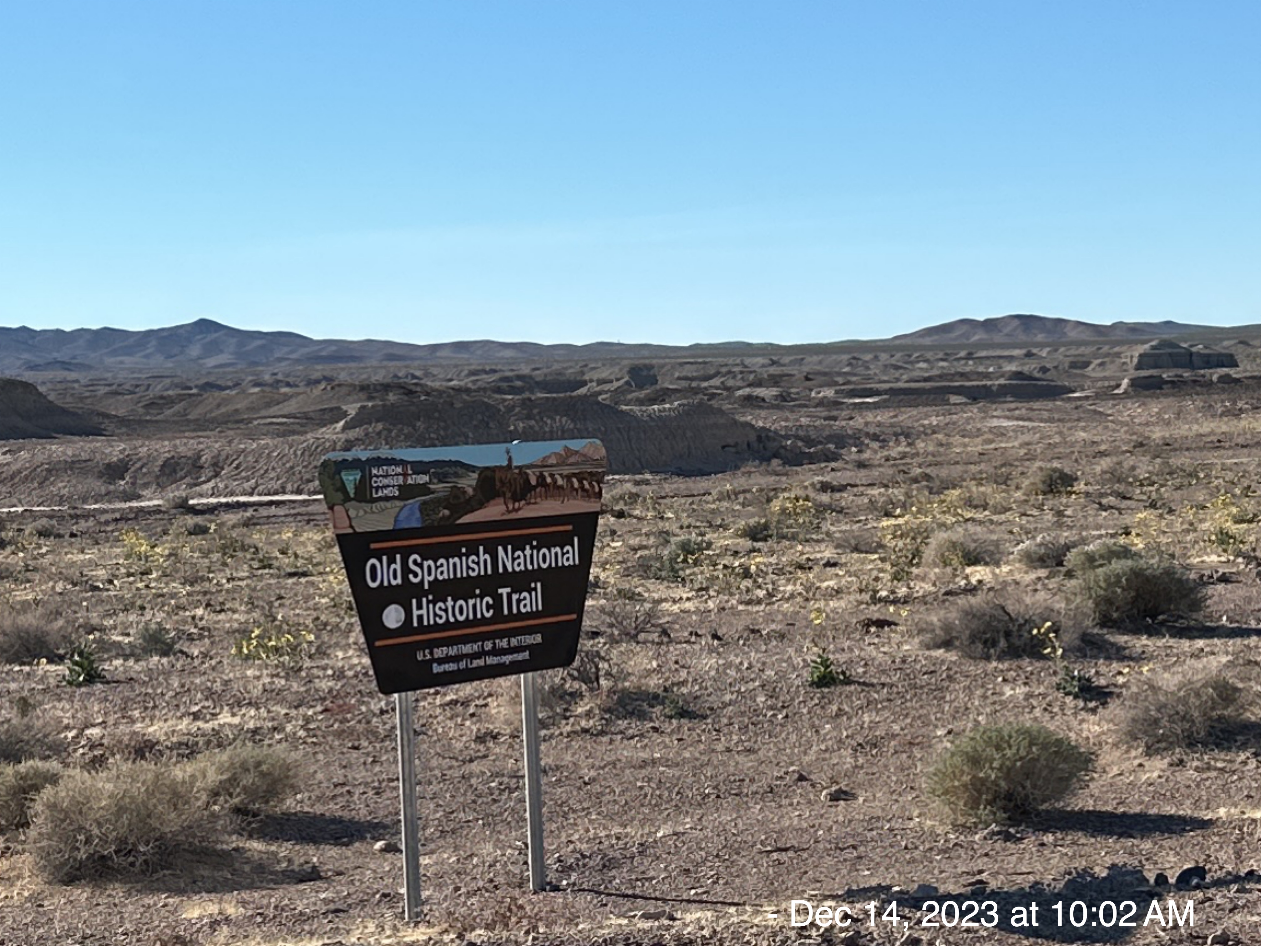
CLICK HERE FOR MY TRAVELS ON NATIONAL HISTORIC TRAILS
BEST PARTS
The flush toilets were outstanding. I’ve suffered from much worse… I’m looking at you Mt. Pinos!!!
Post Script:
1 week after my camping/bike-riding trip, I received an email from “Adventure Cycling Guided Tours“, advertising a van-supported tour in Death Valley (labeled as difficulty level: 4). They encouraged me to pay $3,000 to enjoy spectacularly clear nights and embrace desert solitude on an eight-day tour. Funny thing… their tour includes the same route I went on from “… Furnace Creek, to Badwater Basin – the lowest point in North America – before heading to Artist’s Drive, where a challenging climb will be rewarded with views of Artist’s Palette, a colorful rock formation. After this nine-mile loop, you’ll head back to our camp at Furnace Creek….”.
My trip cost $100 (gas/food/camping fee)… no van-support… unless you count me, because my name is Van… and I supported myself.
Post-Post Script:
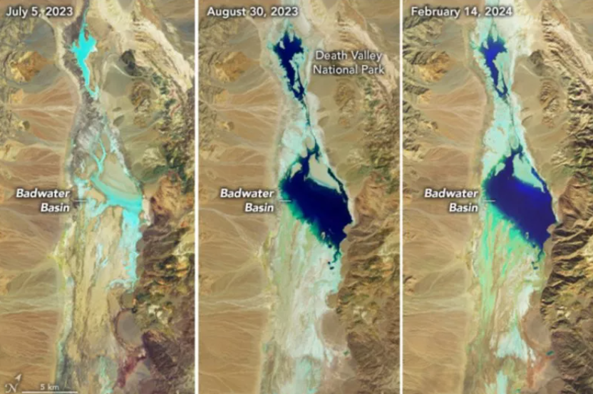
NPS News Release Date: February 8, 2024
DEATH VALLEY, Calif. – An atmospheric river caused a temporary setback in Death Valley National Park’s ongoing recovery from Hurricane Hilary. Most of the park’s primary roads have reopened. The rain enhanced the scenic temporary lake at Badwater Basin.
Death Valley is the driest place in North America, typically receiving about 2 inches of rain per year. The official weather gauge at Furnace Creek has measured 4.9 inches in the past six months, with most of that happening in just two events: the remnants of Hurricane Hilary (2.2 inches on August 20) and the recent atmospheric river (1.5 inches from February 4-7).
Several park roads were closed after flash flooding on the night of February 6. Caltrans removed debris and reopened CA-190 by mid-morning on February 7. The National Park Service cleared debris and reopened Badwater Road by late afternoon. Side roads to some attractions are still closed, including Dantes View, Artists Drive, Devils Golf Course, Mustard Canyon, and Twenty Mule Team Canyon.
Most Death Valley visitors will remember a vast salt flat at Badwater Basin. Heavy rain in August filled the valley floor with a vast, shallow lake. At its largest, it was about 7 miles long, 4 miles wide, and two feet deep. By late January it had shrunk to about half that size, and was inches deep.
“Most of us thought the lake would be gone by October,” said park ranger Abby Wines. “We were shocked to see it still here after almost six months. This week’s rain will extend how long the lake is here. It’s too shallow to kayak in, but it makes amazing reflections of the mountains.”
Post-Post-Post Script:
NASA Images Show How Death Valley Lake Was Refilled
Van, I am so proud of you! Sounds like a great trip! What a terrific accomplishment!
You are our hero! The camping champ! ❤️❤️🙏🙏 Dee
You’re a “great” man Charlie Brown, and, of course, my hero!!! Thanks for putting a great big smile on my face. Looking forward to our next adventure.